Ocean Shores
Southern Willapa Bay Watershed
When thinking like a watershed, envision not just the river, but also the boundaries of watersheds, the land through which rivers flow, and the receiving estuaries, bays, and ocean shores.
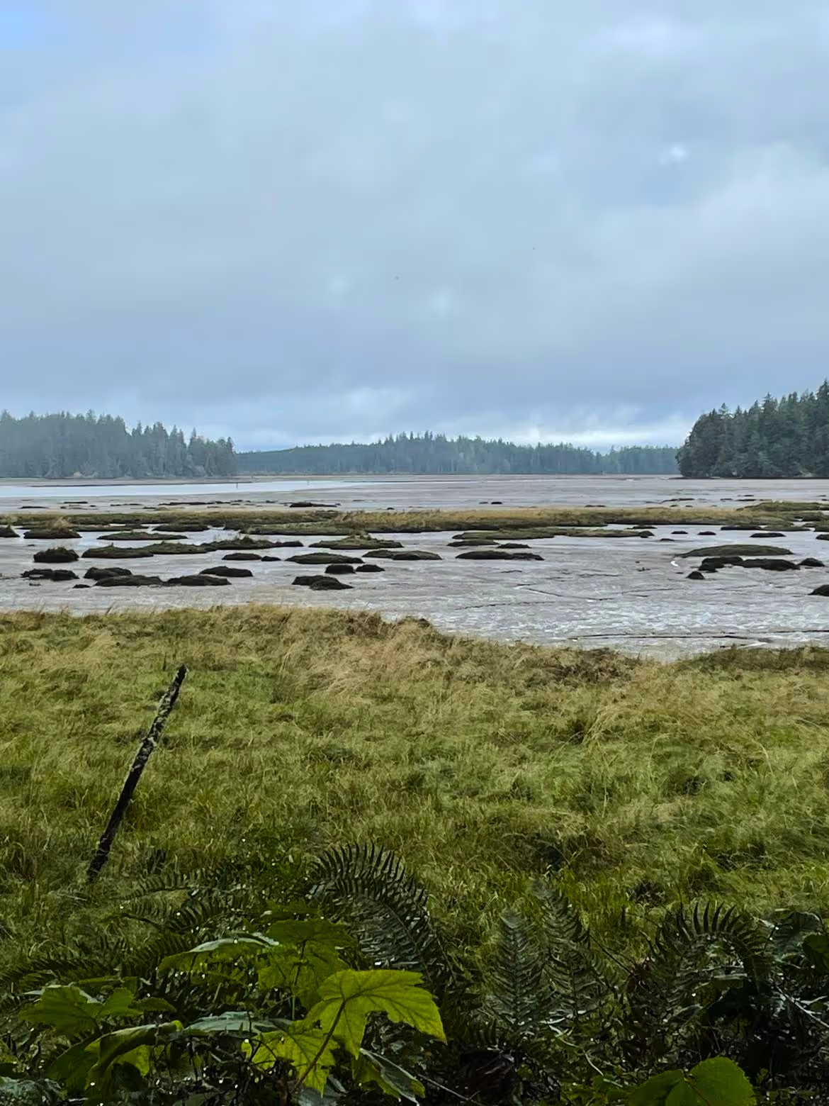
Washington’s Pacific Coast has two large bays, the twin harbors of Willapa Bay to the south and Grays Harbor to the north. Each bay constitutes a watershed with numerous affluent or in-flowing rivers and estuaries. The focus of this blog is the southern part of the Willapa Bay watershed. Willapa Bay covers 378 km sq or 93,447 acres and is bordered by the Coastal Range. The watershed is composed of 87% private and 13% public lands in this predominantly forested region characterized by hay/pasture in the lowlands. The dominant land use includes forestry, dairy and beef farms, cranberry farms, shellfish farms, harbors, and the Willapa Bay Wildlife Refuge. Bound along the outer coast by the Long Beach Peninsula to the south and the Tokeland headland to the north, Willapa Bay forms many rich estuaries and marshes that are conserved in the Bone River Natural Area Reserve, Willapa National Wildlife Reserve, and the Willapa National Wildlife Refuge. The southern part of Willapa Bay watershed is composed of the Bear River, Naselle River, and Nemah River watersheds.
The Bear River watershed, including estuaries, is 100 sq km or 24,771 acres in size. It is the southernmost watershed flowing into Willapa Bay. The headwaters, in part, are found along Bear Mountain, elevation 1025 feet. The Bear River flows from this elevation to sea level in 12.6 miles along the mainstem, indicating a significant change of elevation along a short distance. The upper part of the Bear watershed is likely composed of high energy or high gradient tributary streams. Bear River land cover includes evergreen forests in the highlands, transitioning to lowland forests and wetlands near the mouth of the river, as it enters Willapa Bay. Land use includes logging, farming, the Indian Creek Dam, small residences, roads including US HWY 101, and the Willapa Bay Wildlife Refuge. The Bear River is tidally influenced along its last 3.5 miles before emptying into Willapa Bay.

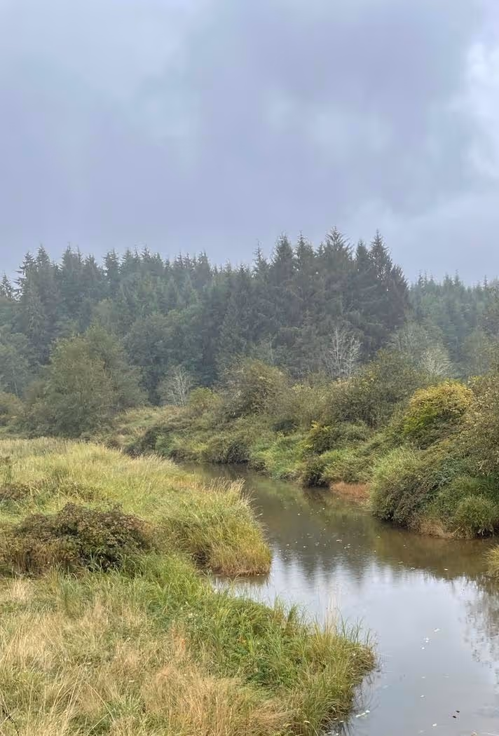
The Naselle River watershed is north of Bear River and is a much larger system covering 347 sq km or 85,503 acres. The Naselle River watershed is separated from the Bear River and other watersheds by the Coast Range including Cowan Peak Lookout (1955 feet elevation), Trap Creek Lookout (2152 feet elevation), Longfellow Hill (975 feet elevation), Salme Hill (540 feet elevation), and Deep River Hill (725 feet elevation). The watershed is divided into the Upper, Middle, Lower Naselle and headwater tributaries. The upper and headwater regions of the Naselle are likely high energy streams emptying the Coast Range. The Lower Naselle River flows through a wide, low energy plain and is heavily influenced by tides. Naselle River has three major tributaries as well as the headwaters region. Upstream of the tidal influence, the Naselle River is significantly narrower. Land cover in the Naselle River watershed is similar to the Bear River land cover, but is characterized by a greater percentage of pastures/hay lands, and lowland valleys, with emergent, herbaceous wetlands in its lower reaches. Land use is similar to Bear River watershed with the addition of a small, unincorporated town of Naselle, and its mouth borders the Willapa National Wildlife Refuge.
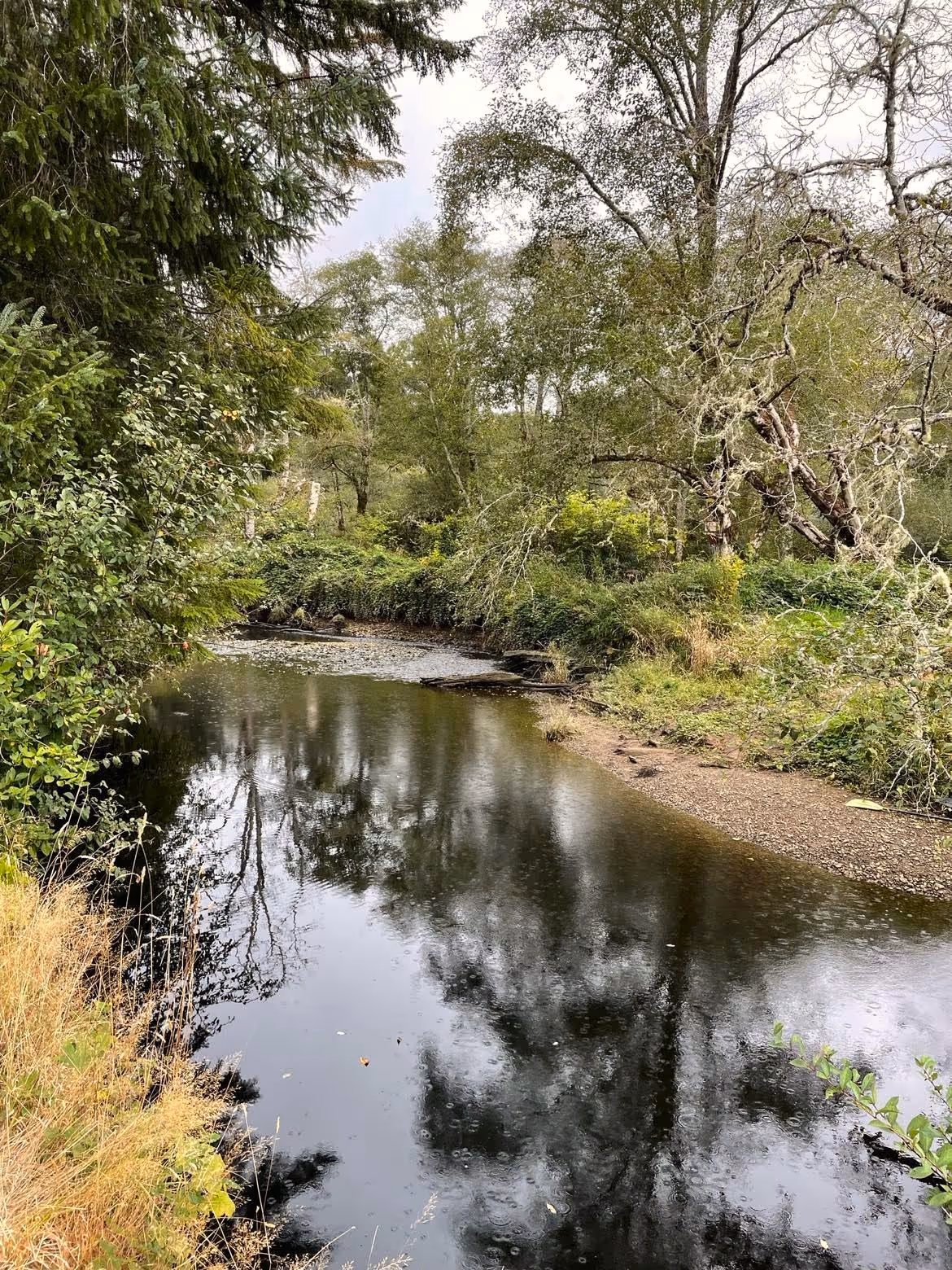
The Nemah River watershed flows into Willapa Bay north of the Naselle River and is bordered by Cowan Peak Lookout (1955 feet elevation) and Trap Creek Lookout (2152 feet elevation). It is comprised of three low-gradient and separate forks that flow into Willapa Bay. The watershed covers 147 km sq or 36,198 acres and flows 119 stream miles along the mainstem and tributaries. Land cover and land use is similar to the rest of the southern Willapa Bay watershed with the addition of a salmon hatchery.
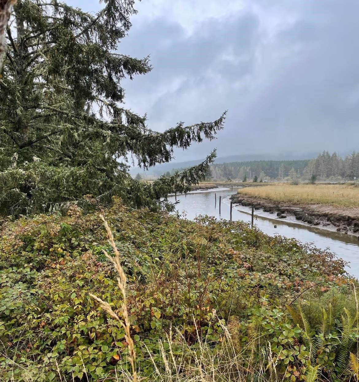
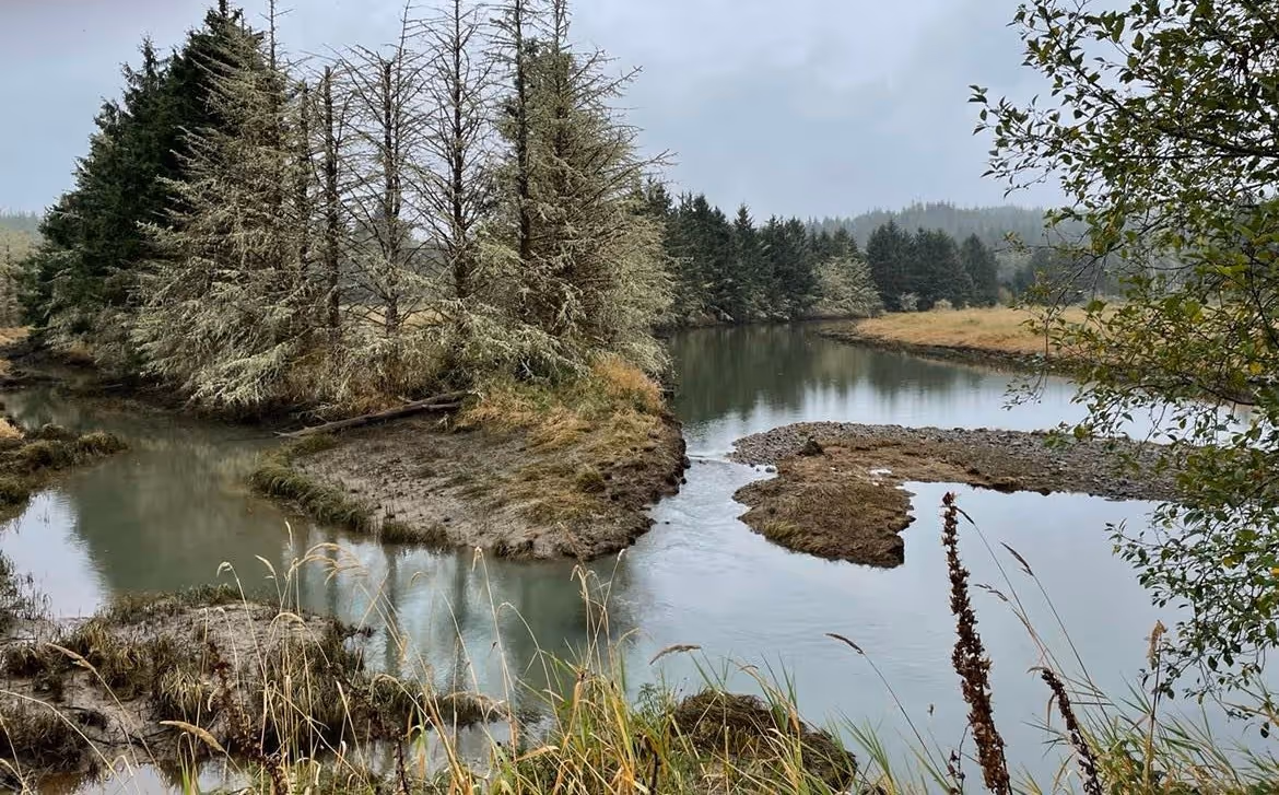
The southern Willapa Bay watershed is characterized by numerous shallow, low energy tidal sloughs that flow short distances before emptying into Willapa Bay.
The Willapa Bay watershed supports rearing and spawning of Pacific salmon. Degradation of salmon habitat was identified as a cause for decreasing numbers of Pacific salmon in the late 1990s. Sedimentation from roads, loss of riparian habitat (trees lining streams), and culverts all contributed to observed declines. However, a coalition of interested parties or stakeholders stepped in and improved habitats reversing the decline. Today parts of the Bear River watershed have been restored and support general rearing of Pacific salmon as well as Chum spawning. Upstream tributaries of the Bear River are characterized by more energy and greater flow supporting spawning and rearing habitat for Chum, fall Chinook, Coho and winter steelhead.
The Ellsworth Creek tributary of the lower Naselle is characterized by silty and sandy sediments downstream and gravel upstream sediments, supporting Chum, Chinook, Coho and winter steelhead spawning. The North Fork Nemah River and its Williams Creek tributary support spawning of fall Chinook, Coho, Chum, and winter Steelhead populations.
Extensive work has been done to support restoration of Pacific salmon habitat in the Willapa Bay watershed, work that has shown some success over the past twenty years.
However, these watersheds are under a relatively new threat, the invasive European green crab. These crabs threaten land use in the region, particularly shellfish farms, and threaten Pacific salmon by damaging and potentially destroying eelgrass beds and other estuary habitat important for sustaining populations of salmon. The European green crab populations are being monitored by the Washington Sea Grant crab team and its cadre of citizen scientists.
The Willapa Bay Watershed is a beautiful region, crowned by forests, with rivers running with Pacific salmon, other native fish, and a diversity of other wildlife. Please take some time to visit this beautiful part of Washington’s Olympic Coast.
References
Coastal Salmon Partnership. 2015. WRIA 24 Lead Entity Manual. https://www.coastsalmonpartnership.org/wp-content/uploads/2019/02/Pacific-County-WRIA-24-Lead-Entity-Strategy-2015.pdf (Last accessed 20 September 2022).
Herring, C., Pope, J., McClellan, B., and Jennings, L. 2020. Draft Comprehensive Review of the Willapa Bay Salmon Management Policy C-3622 2015-2018. https://wdfw.wa.gov/sites/default/files/publications/02157/draft_jul2020_wdfw02157_0.pdf
NRCS. 2006. Willapa Bay Watershed Rapid Watershed Assessment. https://www.nrcs.usda.gov/Internet/FSE_DOCUMENTS/nrcs144p2_034700.pdf. (Last accessed 20 September 2022).
Science in your watershed. 2022.
Washington Department of Fish and Wildlife. 2022. European Green Crab. https://wdfw.wa.gov/species-habitats/invasive/carcinus-maenas. (Last accessed 20 September 2022).
Washington Open Geospatial Portal. 2022. Hydrologic Cataloging Unit (12 digit HUC) | Hydrologic Cataloging Unit (12 digit HUC) | Washington State Geospatial Open Data Portal. (Last accessed 20 September 2022).
Washington Sea Grant Crab Team. 2022. WSG Crab Team – Washington Sea Grant. (Last accessed 20 September 2022).
Waters to watch. 2022. Bear River Estuary, Washington (Retrospective) | National Fish Habitat Partnership. (last accessed, 15 September 2022).
© Barbara Hayford, September 2022
Touch whale bones, examine shipwreck artifacts and connect with the coast's living history.

Support our mission, get involved in educational programs, or contribute through donations and volunteering.