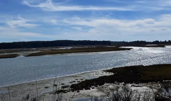
Coastal Watersheds
Coastal Watersheds: Columbia River Watershed, Time and Ancient Floods
Coastal watersheds link the land to the rivers and the rivers to the sea through both space and time. The temporal story of how the Columbia River links to Washington’s Pacific Coast is one of massive lava flows, ancient lake floods, volcanos, and grand cascades of water.

Rivers are long-lived systems, meaning that their channels have carved through the surrounding landscapes sometimes for millions of years. The slow, steady force of water shapes the river channel. Gravity and the overall force of the water, measured as flow discharge, and other physical and climactic factors help shape the path the river takes to the sea.

The main stem of the Columbia River flows north and then south across the northern Rocky Mountains, then it generally flows south before heading west toward the Pacific Ocean. However, as the Columbia turns south, it appears to take a detour west across the central plains of Washington State. This “detour” is likely the result of the Missoula Floods, a series a floods from about 12,000-15,000 years before present. These floods formed when Glacial Lake Missoula, an ice-dam lake that may have been as large as Lake Michigan, repeatedly broke free of its ice dams. Imagine Lake Michigan pouring out of its basin in a sudden and massive flood. These flood waters released up to 17 million cubic meters per second of water across Washington, Idaho, and Northern Nevada tearing through ancient basalt beds and scouring the region known today as the Channeled Scablands. The greatest flood flow equaled the volume of all the rivers in the world combined and may have been up to 1000 feet deep. This force was so great that the Channeled Scablands may be seen from space.
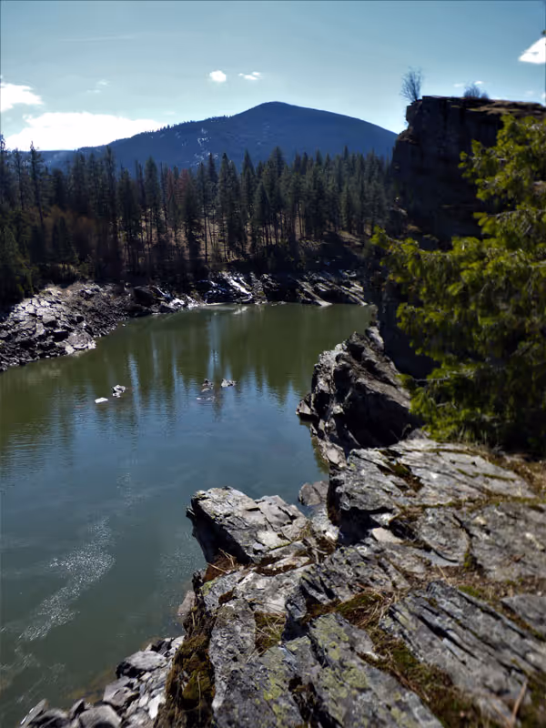
The force of the water was enough to carve out basalt, an igneous rock formed from rapid cooling of some types of lava. Extensive basalt beds are found in the region originating from massive “flood” eruptions about 16 million years before present. These eruptions did not spring from volcanos, rather the lava flowed up from the ground and during a relatively short period of geological time coated parts of Washington, Idaho, and Oregon with thick layers of basalt. The basalt is best viewed along the lower Columbia and the Columbia River Gorge.
As the river flows through the Columbia River Gorge, it picks up speed. Prior to the formation of the dams, the river cascaded through the Gorge. The Cascade Mountains formed starting seven million years ago accompanied by massive upheavals and volcanic eruptions. The Cascades are younger than the Columbia River and as the mountains formed, the river carved a path through the basalt creating the lower river basin and the Gorge. In fact, the Columbia River is the only river to cross the Cascade Mountain Range. The river forms no delta to capture its energy as it flows into the Pacific Ocean. Thus, the Columbia River is the fourth largest river in the United States by discharge with 7,500 cubic meters of water flowing into the ocean per second.

This river is ancient and over the past 17 million years it has been shaped by basalt and ancient floods and has shaped the landscape in turn, eroding the bedrock of the Northern Rocky Mountains and Cascades down into boulder, then rocks and cobble, then gravel and sand. One source for sand in the oceans is from rivers. The Columbia River releases a massive amount of energy as it flows into the Pacific and carries sand originating upstream in space and far back in time. The great force of the Columbia’s final discharge drives water and sediment far out into the Pacific where it circulates north and south. So, some of the sand we find along our beaches started as bedrock in the Cascades and Rocky Mountains thousands to millions of years ago.
Think about that the next time you wiggle your toes in the sparkling sands of Washington’s Pacific Coast.
References
Berdeal, I.G., B.M. Hickey, and M. Kawase. 2002. Influence of wind stress and ambient flow on a high discharge river plume. Journal of Geophysical Research, Oceans. 107 doi.org/10.1029/2001JC000932
Cascades Volcano Observatory. 2022.Columbia River Basalt Group Stretches from Oregon to Idaho. (last accessed July 23, 2022)
Glacial Lake Missoula. 2022. https://www.glaciallakemissoula.org/ (Last accessed on July 23, 2022)
Data Basin. 2022. https://databasin.org/about/ (last accessed May 17, 2022)
Kasbohm, J. and Schoene, B. 2019. Rapid eruption of the Columbia River flood basalt and correlation with the mid-Miocene climate optimum. Science Vol 4, Issue 9 DOI: 10.1126/sciadv.aat8223
O’Connor, J.E., and Costa, J.E., 2004, The world’s largest floods, past and present—Their causes and magnitudes: U.S. Geological Survey Circular 1254, 13 p.
Reidel, S.P., and Tolan, T.L. 2013, The late Cenozoic evolution of the Columbia River system in the Columbia River flood basalt province, in Reidel, S.P., Camp, V.E., Ross, M.E., Wolff, J.A., Martin, B.S., Tolan, T.L., and Wells, R.E., eds., The Columbia River Flood Basalt Province: Geological Society of America Special Paper 497, p. 201–230, doi:10.1130/2013.2497(08).
Stanford, J., Hauer, F.,Gregory,S., and Snyder,E. 2005. Pp 591-641 In Benke, A. and C. Cushing (eds.) Rivers of North America. Elsevier Academic Press, Burlington, MA.
USGS. 1981. River basins of the United State: the Columbia. US Government Printing Office, Washington D.C. 4pp.
© Barbara Hayford, July 2022
Touch whale bones, examine shipwreck artifacts and connect with the coast's living history.

Support our mission, get involved in educational programs, or contribute through donations and volunteering.